


ATTENTION, PHASE 3 WATER SHORTAGE declared by Southwest Florida Water Management District. Learn more.


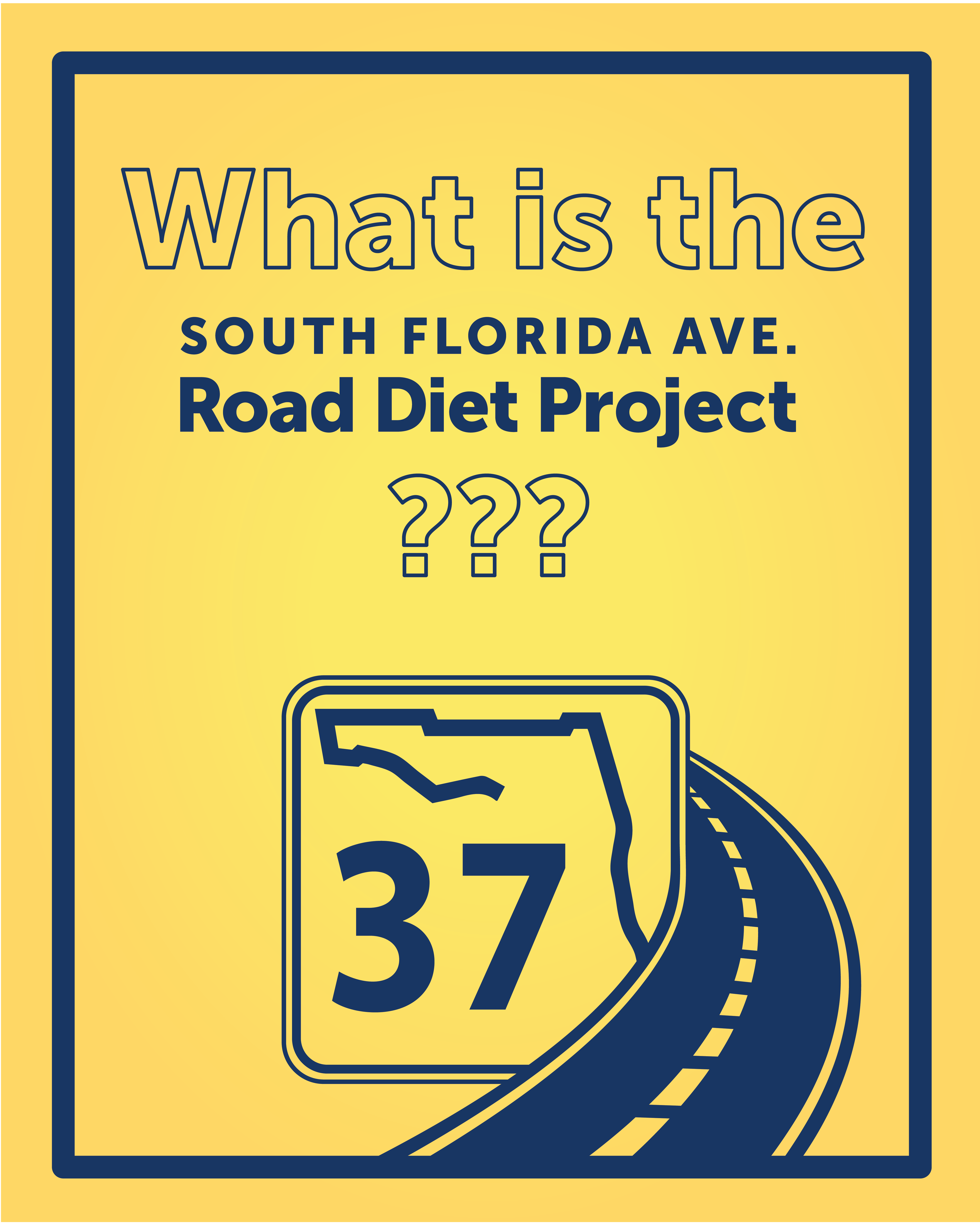
State Road 37 South Florida Avenue Road Diet
Project Overview
Video Playlist
State Road 37 South Florida Road Diet
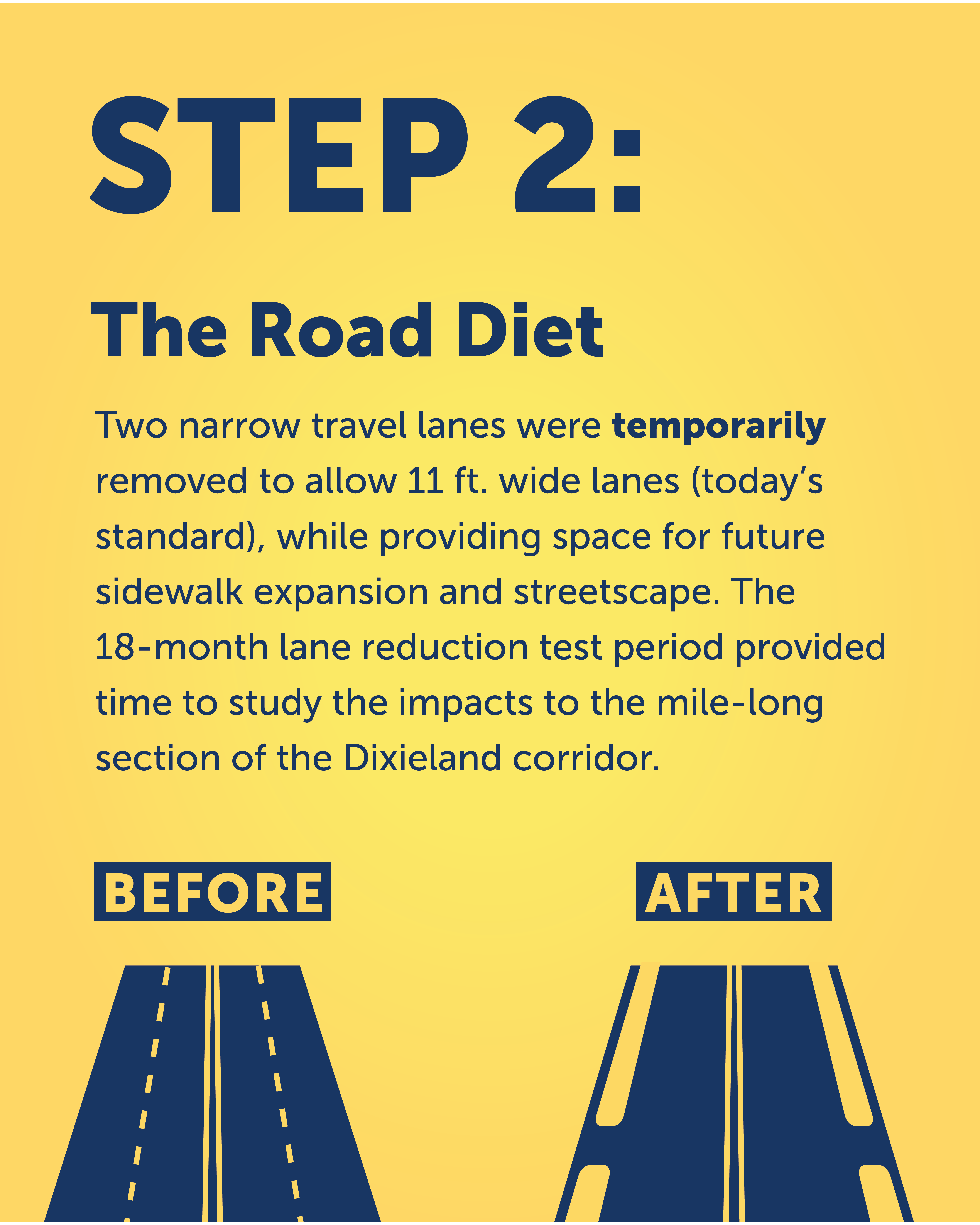
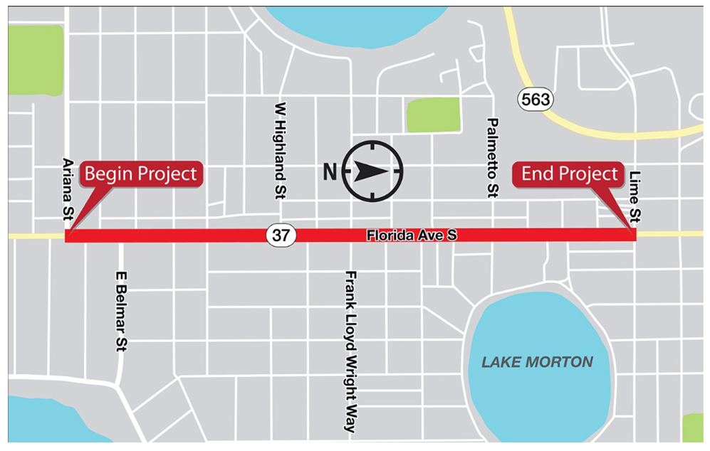
For the past 18-months, the one-mile Dixieland corridor of South Florida Avenue (SR 37) from Ariana Street to Lime Street has been part of a lane reduction or road diet test. The new traffic pattern reduced South Florida Avenue from two lanes in each direction with a center turn lane to one lane in each direction with a center turn lane.
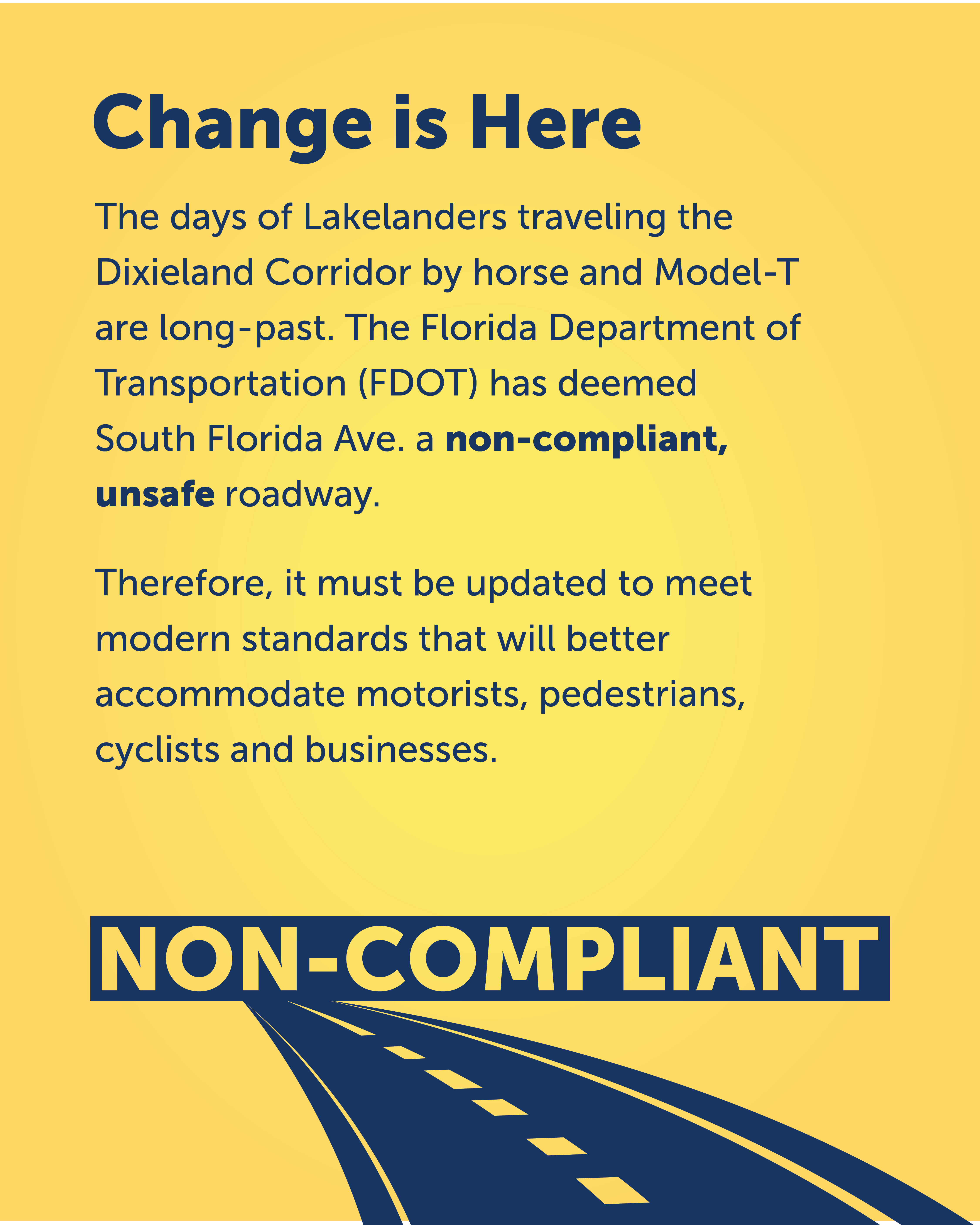
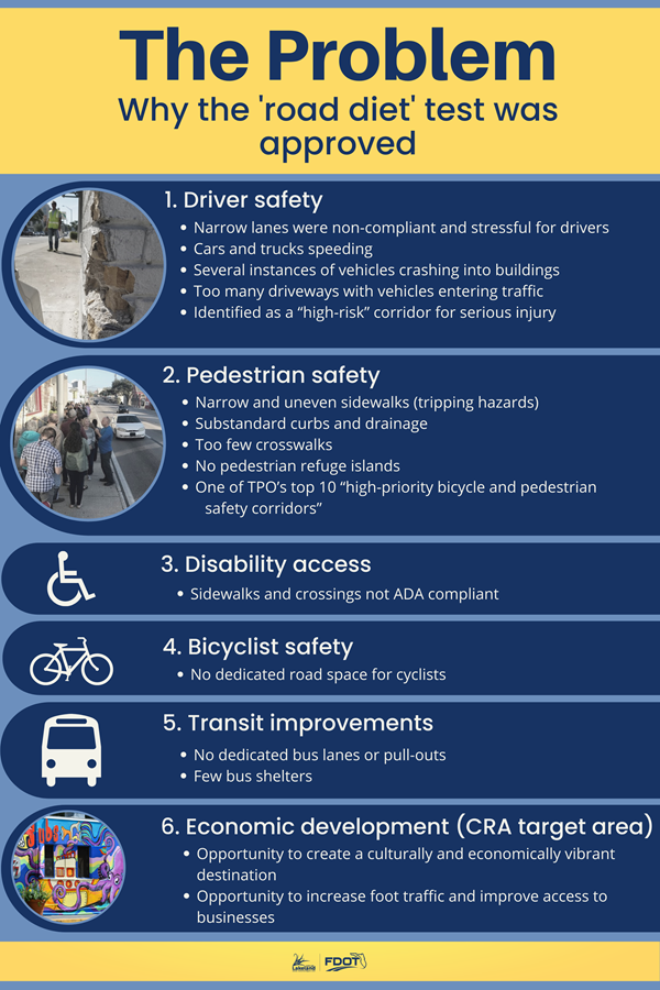
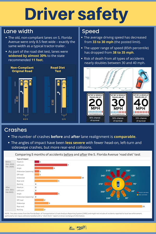
The original five lanes were non-compliant and did not meet today’s safety standards. The 8.5 ft. wide lanes were much narrower than the Florida Department of Transportation’s (FDOT) 11 ft. wide state road requirement. A typical tractor-trailer today is 8.5 ft. wide so the narrow lanes left no margin of error and were unsafe. The reduced traffic pattern has been studied for effectiveness over the past 18-months by more than 90 sensors to see how the lane realignment impacted the one-mile Dixieland corridor.
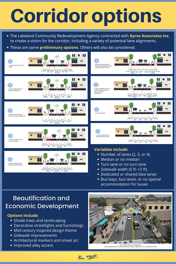
The temporary, lane reduction test allowed the widening of lanes to standard 11 ft. wide widths, while providing possible space for bike lanes and future sidewalk expansion. If the three-lane configuration is made permanent, about 18-ft of asphalt would be repurposed to enhance walkability, bike-ability and shop-ability through the emerging Dixieland corridor. Possible improvements include wider sidewalks, bicycle lanes, landscaping, outdoor dining, accessibility improvements and neighborhood architectural markers.
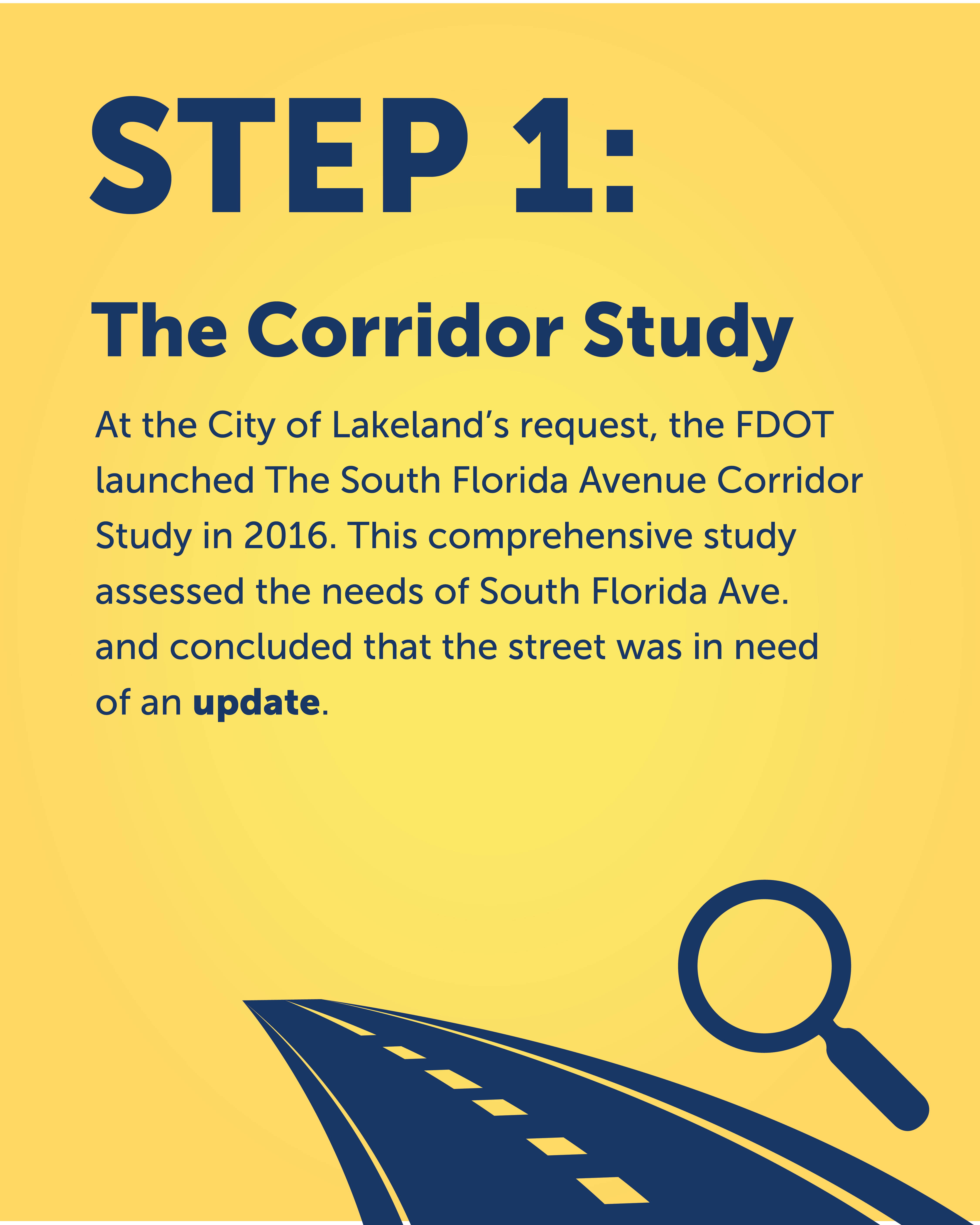
City of Lakeland Transportation Planner, Chuck Barmby said, “The unsafe conditions of South Florida Avenue through the Dixieland corridor raised concerns and moved FDOT to initiate the South Florida Avenue traffic study through the Dixieland area in 2016. This was a “first-of-its-kind” study in Florida that included traditional transportation analyses, and innovative components such as a marketing analysis, a day-long community planning meeting (known as a charrette), a week-long design studio within a storefront on the corridor, public meetings, and interviews with stakeholders in the study area.”
The 2016 study also evaluated potential development sites, parking inventory, and transportation alternatives including the initiation of the South Florida Avenue road diet to expand lane widths to meet today’s safety requirements. The City of Lakeland created a storyboard that helps give background information on the project. The storyboard can be found here: http://bit.ly/LakelandRoadDietTest.
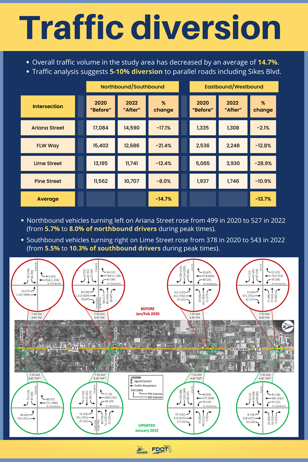
Barmby said, “We continue to get a lot of questions regarding the impact to neighboring side streets. We are starting to compile the test data that we will soon be sharing with the community. It is also important for the community to know that the Citrus Connection established a new bus route called the Peach Line that does not have any stops in the one-mile lane reduction area, so travelers are not hindered by frequent bus stops through the corridor.”
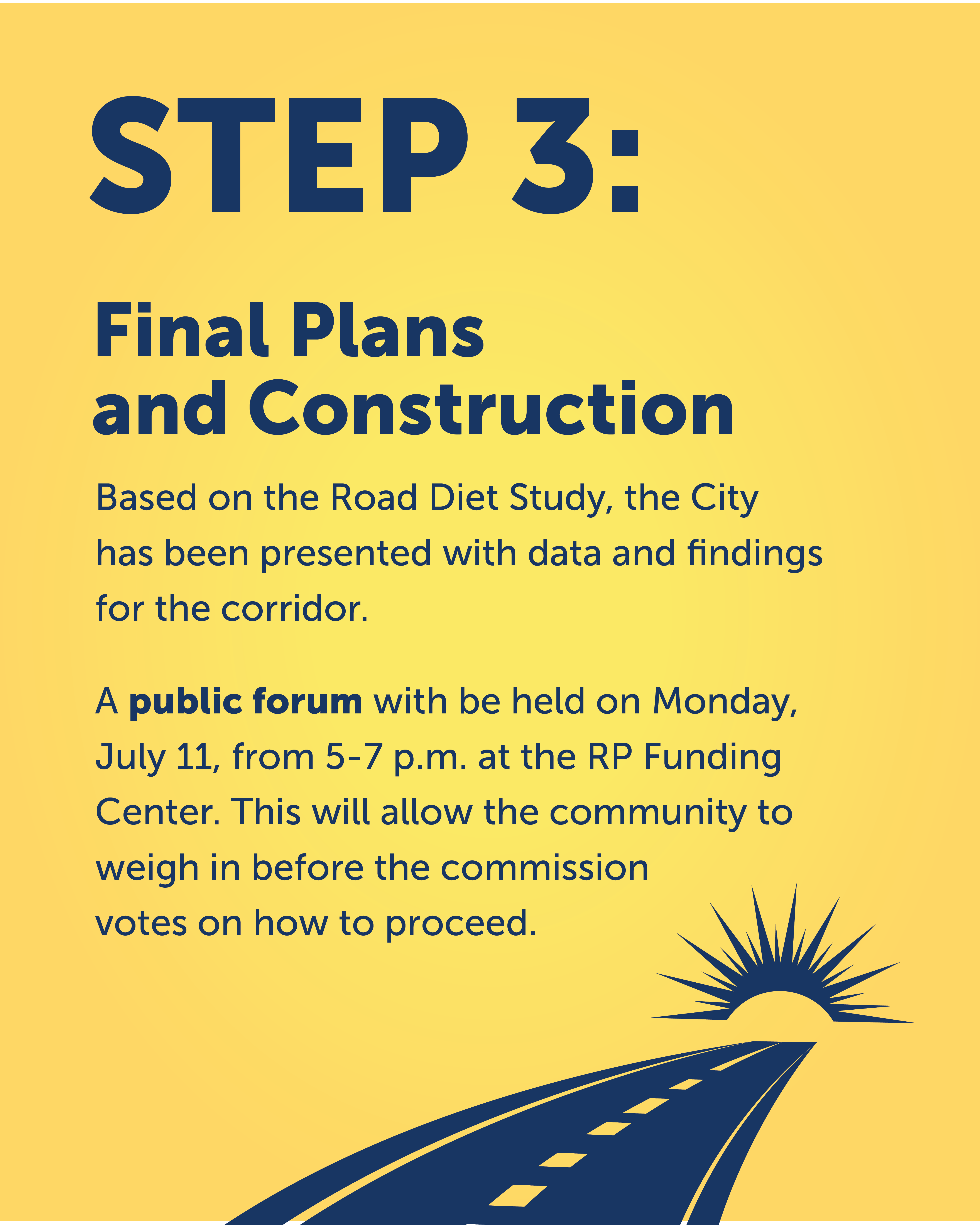
The testing phase is complete and now FDOT is compiling data from the monitoring sensors. A public meeting hosted by the City of Lakeland and FDOT will take place at the RP Funding Center on July 11 to share the study results and to gather community input.
For more information on this FDOT project, visit swflroads.com/sr37/arianatolime.
...
For over a decade, the Lakeland community has struggled with how to make Florida Avenue a safer and more functional street for all users to enhance the economic vitality of Dixieland Downtown and the surrounding neighborhoods.
View Interactive Storyboard
Public Meeting
There was an open-house style public meeting at the RP Funding Center on July 11, 2022 to share information about the project and allow the community to weigh in before the city commission votes on how to proceed. The meeting drew 118 participants as well as several elected officials. It was co-hosted by the Florida Department of Transportation and the City of Lakeland.
These were poster boards displayed at the meeting | view PDFs here
![]()
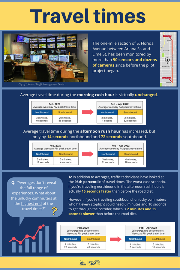
Travel Time Report
The one-mile section of S. Florida Avenue between Ariana St. and Lime St. has been monitored by more than 90 BlueTOAD sensors and dozens of cameras since before the pilot project began. Data has been collected by the City of Lakeland’s Traffic Management Center, the Florida Department of Transportation, and Traffic Engineering Data Solutions, Inc.
How has the 'road diet" impacted travel times? | view here
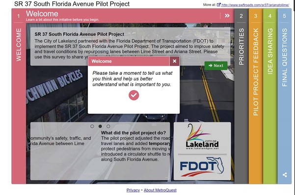
Florida Department of Transportation Survey
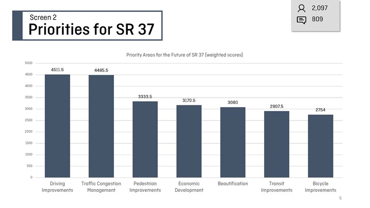
The FDOT conducted a survey using the MetroQuest platform, which allowed residents to drop pins on a map and share specific suggestions or comments. The survey received 2,276 responses. Participants' top priorities included driving improvements, traffic congestion management, pedestrian improvements, economic development, and beautification. More information about the results will be presented to the city commission in the fall.
Additional Resources
South Florida Avenue Road Diet City Commission Workshop - August 2, 2021 | view here
FDOT | view here
The Lakeland City Commission has approved a Memorandum of Understanding (MOU) with the Florida Department of Transportation (FDOT) for the SR37 road reconstruction project and entered into a Professional Service Agreement with Patel, Greene & Associates for roadway engineering and design to accelerate construction planning. The City of Lakeland plans to gather public input in Fall 2025 on the project’s design and aesthetic elements, including landscaping and hardscaping. The design phase is expected to be completed in approximately two years. See concepts.